This page will be discontinued on April 1, 2023. For more information on how CO-OPS monitors storm surge during tropical cyclones, please bookmark https://tidesandcurrents.noaa.gov/inundationdb_info.html.
Monitoring Water Levels During Hurricanes and Tropical Storms
Storm QuickLook
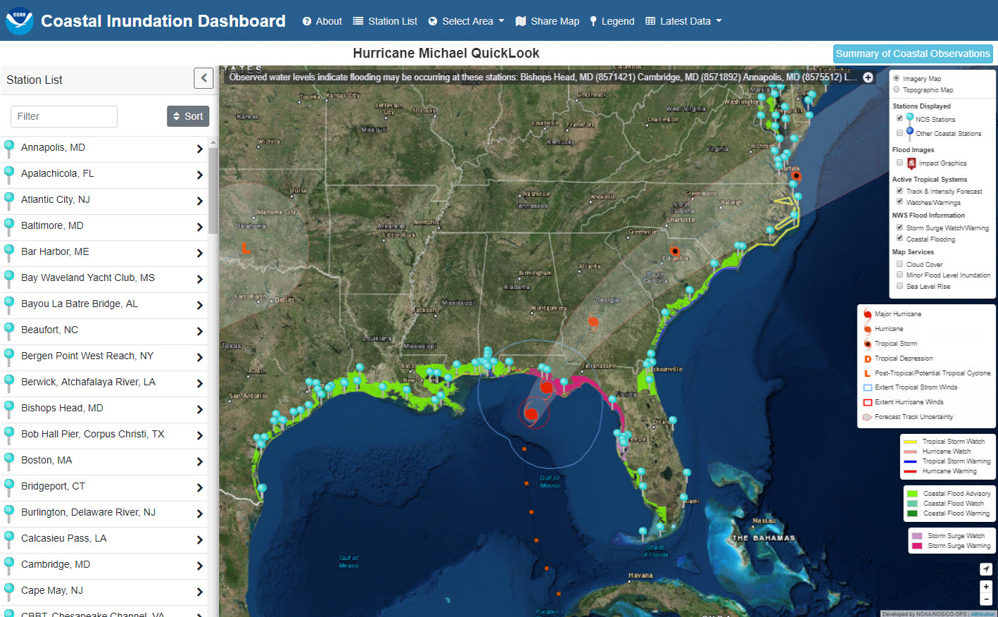
The Center for Operational Products and Services (CO-OPS) monitors and disseminates elevated water level conditions along the coast when a tropical storm or hurricane watch or warning is issued by the National Weather Service (NWS). Beginning with the 2019 hurricane season, the Storm QuickLook product will now be disseminated as an interactive map-based web tool through the Coastal Inundation Dashboard. This customized map will show the latest tropical cyclone forecast track and intensity information, active storm surge watches or warnings, and coastal flood watches, warnings or advisories issued by NWS. A summary of coastal water level & meteorological conditions will be updated three times daily.
Water levels within the Coastal Inundation Dashboard product are referenced to Mean Higher High Water (MHHW), the average highest tide in a day. This differs from navigation-based products which typically reference water levels to Mean Lower Low Water (MLLW), or the average lowest tide in a day, since the focus of these products are under keel clearance. Water level observations that are positive when referenced to MHHW indicate that ground that is typically (on average) not wet may be impacted by water. Tropical cyclones and other strong coastal storms, such as nor’easters, can elevate water levels by several feet or more above normal tide levels, which can cause flooding along the coast.
In addition to real-time storm surge observations, CO-OPS compiles peak water level observations following every storm that impacts the U.S. coast. This information is provided to NWS for their tropical cyclone reports and is disseminated through Storm Reports for select high-impact storms.
The below section is taken from the National Hurricane Center Storm Surge Overview page.
-
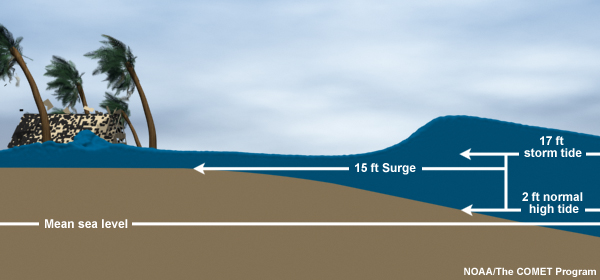
Storm Surge vs. Storm Tide
Storm surge is an abnormal rise of water generated by a storm, over and above the predicted astronomical tides. Storm surge should not be confused with storm tide, which is defined as the water level rise due to the combination of storm surge and the astronomical tide. This rise in water level can cause extreme flooding in coastal areas particularly when storm surge coincides with normal high tide, resulting in storm tides reaching up to 20 feet or more in some cases.