Currents
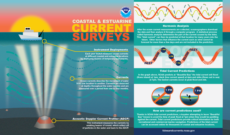
Coastal and estuarine currents describe the movement of water from one location to another. NOAA periodically conducts current surveys in areas around the nation to ensure the accuracy of tidal current predictions. CO-OPS also offers real-time current information as part of many of our Physical Oceanographic Real Time Systems. Commercial and recreational mariners depend on this information for safe navigation. Click on graphic to enlarge. (Download this infographic)
-
NOAA Current Predictions
The predicted time and speed of maximum flood/ebb and timing of slack water for all official NOAA current stations. -
Real Time Currents
Real time current information from actively installed current meter stations.
-
Historic Current data
Provides data from historic current surveys.