Monthly Sea Level Anomalies
 |
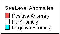
A sea level anomaly reveals the regional extent of anomalous water levels in the coastal ocean which can indicate unusual water temperatures, salinities, average monthly winds, atmospheric pressures, and/or coastal currents. A sea level anomaly, as defined by NOAA's National Ocean Service, occurs when the 5-month running average of the interannual variation is at least 0.1 meters (4 inches) greater than or less than the long-term trend. The interannual variation is the monthly mean sea level after the trend and the average seasonal cycle are removed. The anomalies are mapped by month, using the mid-point of the 5-month running average. When the 5-month average is more than 0.1 meters above the trend, it is indicated on the map in red as a positive anomaly. When it is more than 0.1 meters below the trend, it is represented in blue as a negative anomaly. The interconnection between the oceanic and atmospheric systems can be demonstrated by the coincidence of positive and negative sea level anomalies along the U. S. Pacific Coast with climatic events such as the El Niño Southern Oscillation (ENSO).