The Tampa Bay Operational Forecast System (TBOFS) - Developmental
Oceanographic nowcasts and forecast guidance are scientific predictions about the present and future states of a water body (generally including water levels, currents, water temperature and salinity). These predictions rely on either observed data or forecasts from large-scale numerical models. A nowcast incorporates recent (and often near real-time) observed meteorological, oceanographic, and/or river flow rate data and/or analyzed (e.g. gridded) meteorological and oceanographic products. A nowcast covers the period of time from the recent past (e.g., the past few days) to the present, and it can make predictions for locations where observational data are not available. Forecast guidance incorporates meteorological, oceanographic, and/or river flow rate forecasts and makes predictions about the future states of a water body. A forecast is usually initiated by the state of a nowcast.
For TBOFS nowcasts, meteorological forcing is provided by NCEP's Real-Time Mesoscale Analysis (RTMA). Heat flux is provided by NCEP's North American Mesoscale (NAM) weather prediction model. River discharge is estimated using near-real-time observations from U.S. Geological Survey stream flow gauges. Oceanographic conditions on TBOFS' lateral boundary are estimated by using subtidal water level forecasts from the NWS Extra-Tropical Storm Surge (ETSS) model and are adjusted with observed subtidal water levels at NOS gauges. The tides are from the ADCIRC ec2001 tide database, and temperature and salinity data is provided by the U.S. Navy Coastal Ocean Model (NCOM).
For TBOFS forecasts, meteorological forcing is provided by NAM. River discharge is estimated by persistence of the most recent observations. On the lateral boundary, water levels are estimated by using subtidal water level forecasts from the NWS ETSS model and by using ADCIRC tides. Water temperature and salinity conditions are based on forecasts from NCOM.
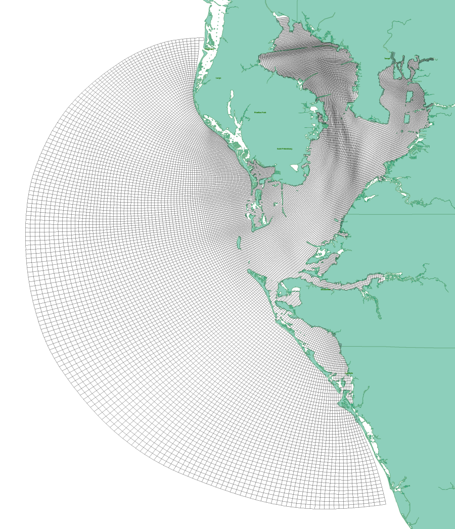
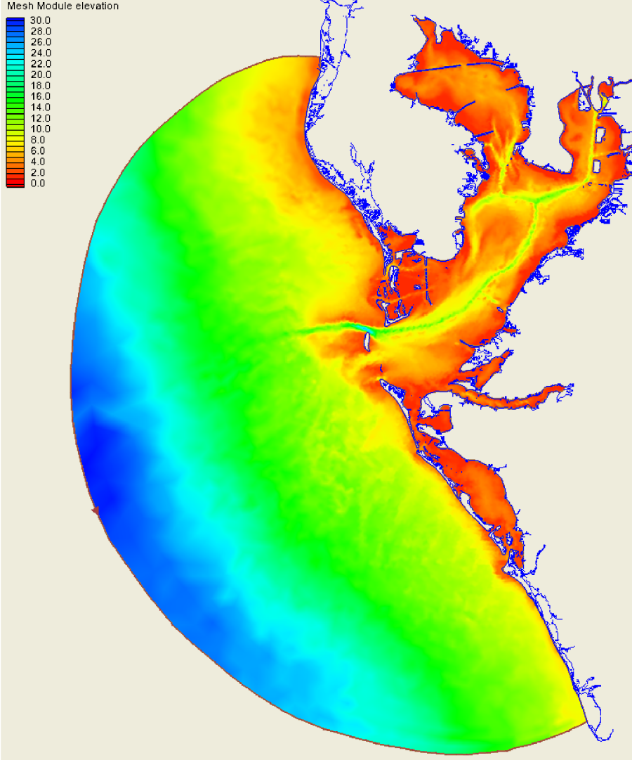
The TBOFS grid has 176 x 290 points in the horizontal. The grid resolution in the x- and y- directions ranges from 100m up to 1.2km. The vertical grid follows the terrain and consists of 11 model levels. The TBOFS model domain was designed to include the whole of the Tampa Bay and a piece of the shelf to allow a realistic interaction between the shelf and the entrance to the bay. The TBOFS grid and spatial extent is indicated above. The bathymetry of the Tampa Bay was obtained from NOS soundings and is indicated below.
TBOFS runs on NOAA's High Performance Computers (HPC) in a new Coastal Ocean Modeling Framework (COMF) developed by CO-OPS. As a result, TBOFS has direct access to NWS operational meteorological products that it needs to run reliably. Nowcast and forecast guidance cycles are run 4 times a day (every 6 hours).
The TBOFS graphics archive is located at: ftp://tidepool.nos.noaa.gov/pub/outgoing/ofs/TBOFS/graphics/
TBOFS output is in NetCDF format. An archive of TBOFS NetCDF nowcast and forecast files can be accessed from CO-OPS OPenDAP and THREDDS servers.
All CO-OPS official real-time products, including nowcast and forecast guidance from TBOFS are monitored by the CO-OPS's Continuous Operational Real-Time Monitoring System (CORMS). CORMS provides 24 hour per day, 7 day per week monitoring and quality control of sensors and data in order to ensure the availability, accuracy, and quality of tide, water level, current, and other marine environmental information. CORMS is intended to identify invalid and erroneous data and information before application of the data by real-time and near real-time users.

