Maritime Services
The National Ocean Service (NOS) is responsible for providing real-time oceanographic data and other navigation products to promote safe and efficient navigation within U.S. waters. The need for these products is great and rapidly increasing; maritime commerce has tripled in the last 50 years and continues to grow. Ships are getting larger, drawing more water and pushing channel depth limits to derive benefits from every last inch of draft. By volume, more than 95 percent of U.S. international trade moves through the nation's ports and harbors, with about 50 percent of these goods being hazardous materials. A major challenge facing the nation is to improve the economic efficiency and competitiveness of U.S. maritime commerce, while reducing risks to life, property, and the coastal environment. With increased marine commerce comes increased risks to the coastal environment, making marine navigation safety a serious national concern. From 1996 through 2000, for example, commercial vessels in the United States were involved in nearly 12,000 collisions, allisions, and groundings.
CO-OPS Maritime Services provides information that improves the safety and efficiency of maritime commerce and coastal resource management through the integration of real-time environmental observations, forecasts and other geospatial information. CO-OPS measures and disseminates observations, predictions and nowcast/forecasts of water levels, currents, salinity, and meteorological parameters (e.g., winds, atmospheric pressure, and air and water temperatures) that mariners need to navigate safely. CO-OPS has also added visibility and waves to the suite of sensors to provide additional information crucial to safe navigation. CO-OPS Maritime Services is made up of several programs that aid mariners in transporting safely and efficiently.
Physical Oceanographic Real-Time System (PORTS®)
PORTS® is a decision support tool that integrates and disseminates real-time environmental observations, forecasts and other geospatial information. In partnership with local port authorities, pilot associations, shippers, the U.S. Coast Guard, the U.S. Army Corps of Engineers, the U.S. Navy, academia, and others, PORTS® currently operates in various bays and harbors in the U.S. The system measures and disseminates water levels, currents, salinity, winds, and atmospheric pressure to various users. PORTS® is a cost-shared program requiring local partners to provide funding for the cost of installation, operation and maintenance of the sensor systems. NOAA provides technical expertise for systems design, 24 x 7 quality control of the data, data collection and dissemination infrastructure and ongoing management of the data. PORTS® builds on NOAA’s water levels and currents program expertise as well as the NWLON observing system infrastructure.
National Current Program
CO-OPS conducts tidal current surveys primarily to update NOAA’s annual tidal current prediction tables. NOAA’s tidal current prediction tables are used by the largest ship operators, as well as the fishing industry and recreational users. U.S. Coast Guard carriage regulations require large commercial vessels to carry NOAA’s annual Tide and Tidal Current Prediction tables along with Nautical Charts for safety. Updated, accurate predictions are essential for these users to navigate coastal areas safely and for fishers to determine best catch times. These predictions, along with NOAA’s current models, are also essential to effective oil spill response strategies Tidal current surveys are also used to assess sites for renewable energy projects that tap into hydrokinetic energy sources such as currents, tides and waves.
National Operational Coastal Modeling Program
CO-OPS operates nowcast and forecast models that provide short term water level and other environmental forecasts that are accurate out to 48 hours and enable better planning and decision making, particularly for vessel transits. These are typically operated in conjunction with PORTS® to address needs for real time data.
-
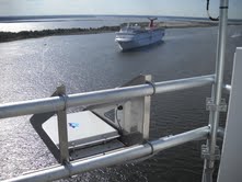
Air gap sensor helping cruise traffic in Jacksonville, FL
-
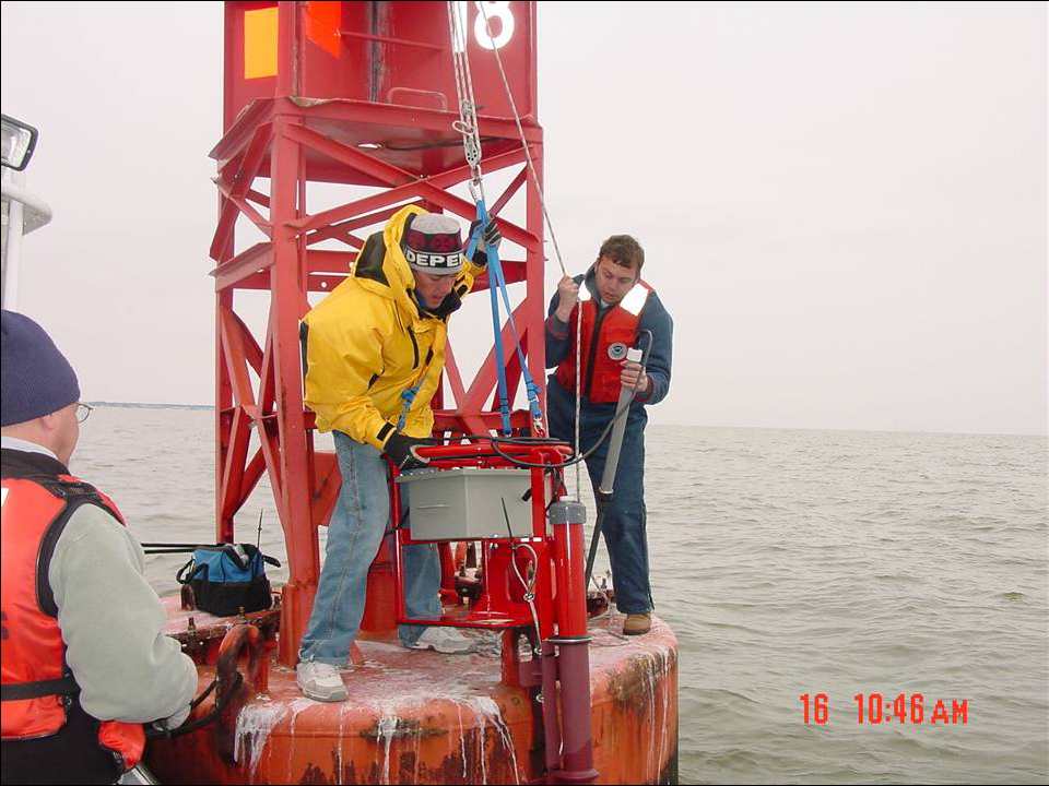
Current meter installation on a Coast Guard buoy
-
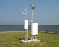
Visibility station in Mobile, AL used to determine fog