Gulf of Maine Ocean Observing System (GoMOOS)
During the winter of 2003, NOS's Center for Operational Oceanographic Products and Services (CO-OPS) and the Gulf of Maine Ocean Observing System (GoMOOS) discussed how both groups could mutually benefit from the observing systems that they operate in the Gulf of Maine. GoMOOS is a national pilot program designed to bring hourly oceanographic data from the Gulf to all who need it. Its users include commercial mariners, coastal resource managers, scientists, educators, search-and-rescue teams, emergency response teams, and public health officials. CO-OPS also delivers numerous products and services to these users. GoMOOS and CO-OPS decided to collaborate on the following activities:
- GoMOOS worked with CO-OPS to become part of the Gulf of Maine Ocean Data Partnership. This will lead to ongoing dialogs and working partnerships that will extend well beyond the scope of this project.
- CO-OPS will be incorporated as a data partner into the FGDC-funded (Federal Geospatial Data Center) project to create a data framework for the Gulf of Maine. This will help CO-OPS make its data products available in a standardized format.
- Efforts will be made to include all CO-OPS data in a geographically oriented (i.e., web-based GIS) display that includes data from all other IOOS data providers in the Gulf. Upon completion of the initial phase, the scope will be broadened to include the rest of the country and other regional observing systems.
- GoMOOS will develop the capability to act as an "aggregation server" for historical water-level data and predictions. This effort was initially focused on sea-surface temperature and wind measurements from other sources, but will be generalized to include water-level data and currents. This means that a dynamic connection between the CO-OPS and GoMOOS websites will be established.
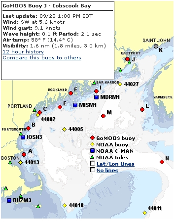
- GoMOOS will take real-time data and predictions from the National Water Level Observation Network and display them on its website. CO-OPS will take GOMOOS' current data and analyze it to produce harmonic constituents. These constituents will allow GoMOOS to display tidal current predictions along with actual observations from the data buoys.
- GoMOOS is also working with its members and regional stakeholders (e.g., educational institutions that use GoMOOS graphing and download tools in their classrooms) to assure that CO-OPS data products are disseminated to those who can benefit from them.
CO-OPS and GoMOOS continue to work on these activities. Some of these efforts will be visible to the public, such as the display of CO-OPS data on the GoMOOS website, but many will be subtle and "behind the scenes." The end result will be a large step toward a national integrated ocean observing system.