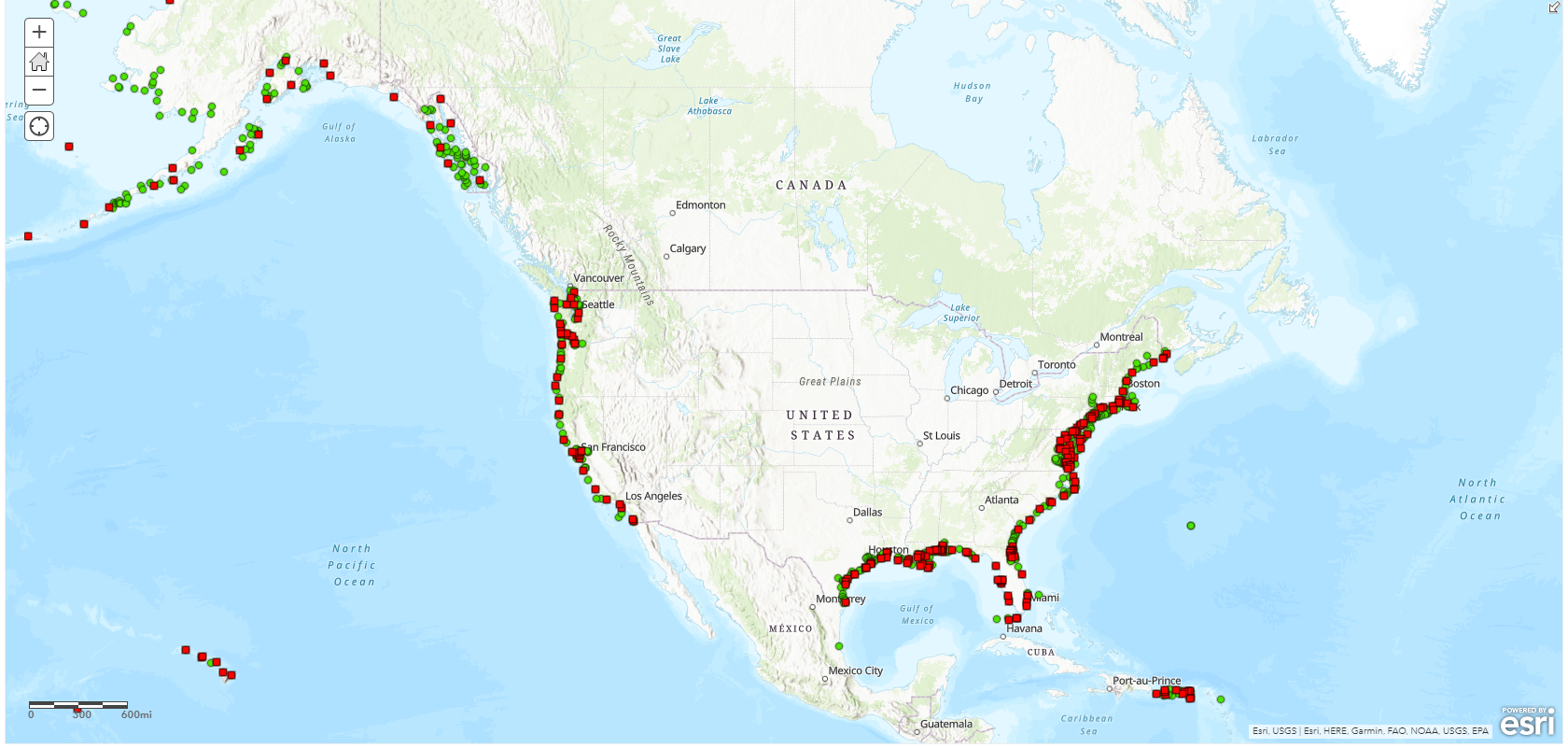
Scope of Our Efforts: Water Level Stations Along the US Coast
An update to the NTDE means that CO-OPS will be recomputing datums from thousands of water level stations, both active and historic, in 23 coastal states and several US territories. There are currently about 250 active stations and 1,730 historic stations that will receive up-dated datums and benchmark sheets.
The map depicted here displays all US water level stations included in the NTDE update. Click on a dot to obtain more information about an individual location.