Scope of Our Efforts: Water Level Stations Across the Great Lakes
An update to the IGLD means that Canadian and US partners will need to collect data from dozens of permanent and seasonal water level stations throughout the Great Lakes region. In the United States, NOAA currently operates 53 permanent gauges that have been supplemented by 54 seasonal gauges. In Canada, the Canadian Hydrographic Survey (CHS) operates 52 permanent gauges supplemented by 68 seasonal gauges. In addition to these networks, the US Army Corps of Engineers, the US Geological Survey, the New York Power Authority, Ontario Power Generation, and Environment & Climate Change Canada operate additional networks of their own gauges.
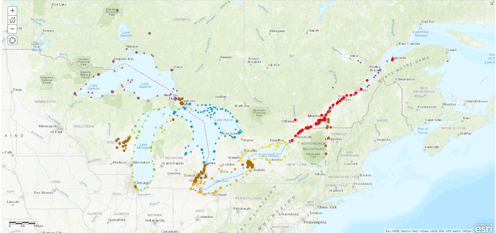
The map depicted here displays all Canadian and US water level stations included in the IGLD update. Click on a symbol, either a circle for permanent stations or a square for seasonal stations, to obtain more information about an individual location. Stations are individually color coded by lake and connecting channels are primarily coded by the color brown.