Low Water Datum
Since the Low Water Datum (LWD) was defined in 1933, the Great Lakes region has experienced significant changes, from changes in channel bathymetry, the addition of new dams and locks, Glacial Isostatic Adjustment, water diversions and the construction of the St. Lawrence Seaway. LWD has received updated reference heights over time as IGLD, and mean lake surface heights, have been recalculated.
The Vertical Control - Water Level Subcommittee (SC) is considering also recalculating the LWD surface for each lake as part of the IGLD (2020) update, as opposed to simply receiving new reference heights.
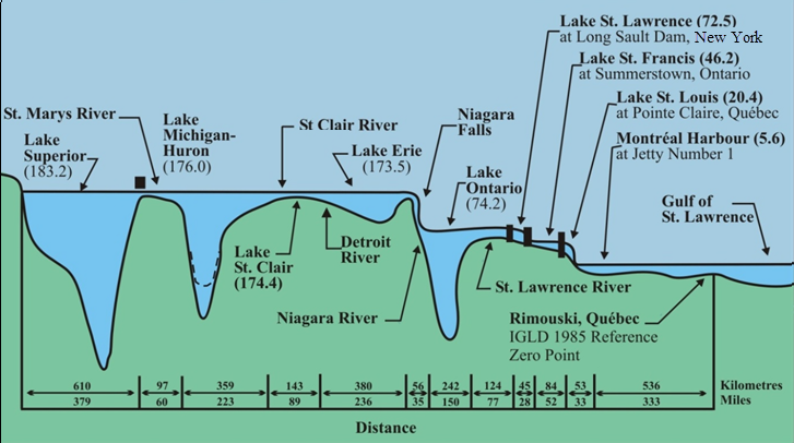
What is the LWD? The LWD identifies a surface so low that the water level will seldom fall below it. Different lakes and rivers use different LWD surfaces.
What will change if the LWD is revised? Depths on navigation charts and navigation channels refer to LWD. On the upper Great Lakes, initial analyses indicate the LWD elevation may be too high. On the lower Great Lakes, calculations indicate that LWD may be too low. Preliminary results indicate that LWD might better represent current lake conditions if it were adjusted anywhere from -6.3 inches (-16 cm) to 18.9 inches (48 cm), depending on the lake.
What is the estimated timeline for the LWD recalculation?
- 2024: Determine if LWD will be recalculated
- 2026: Finalize values
- 2027: Implement during rollout of IGLD (2020)
- Ongoing: Engage stakeholders throughout the process
To obtain LWD for a Great Lake or connecting channel, please visit the Great Lakes Low Water Datums web pages.