NOAA Tide Predictions Users Guide
NOAA Tide Predictions allows users of the Tides and Currents website (http://tidesandcurrents.noaa.gov) to generate tide predictions for up to 2 years in the past or future, at any of 3000+ locations around the United States. This website service provides both a graphical plot of the predictions as well as a tabular listing and printable pages.
This service is found on the main pages of the Tides and Currents website, within the “Products” tab, located on the top menu bar. Select the link for "NOAA Tide Predictions" under the “Tides/Water Levels” heading.
Generating tide predictions for a location:
Selecting a station - Tide predictions can only be accurately predicted at a location where tide data has been collected and analyzed. There are more than 3000 locations available through the NOAA Tide Predictions service.
If you know that a station is available, you may use the search box to provide the station name or 7-digit ID number to retrieve predictions for the station. Otherwise you may search for a station from the map interface or the station listing.
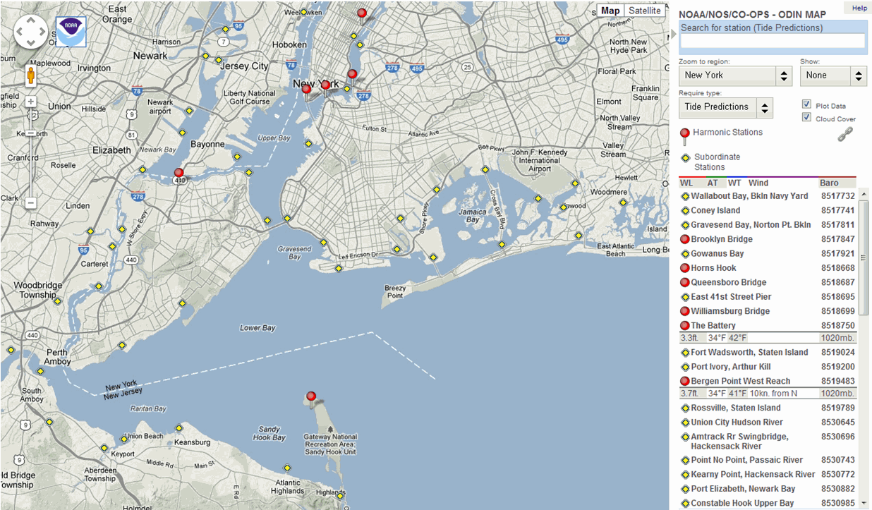
Map Interface:
The Google map interface, Observational Data Interactive Navigation (ODIN), provides access to all types of data available from the Tides and Currents website. This GIS interface has the ability to pan and zoom, allowing you to focus on the area of your interest. By changing the “Require Type” to “Tide Predictions”, the map will display the stations at which tide predictions are available. Clicking an icon in the map or the station name on the right-hand sidebar will access the predictions for the station selected.
Station Listing:
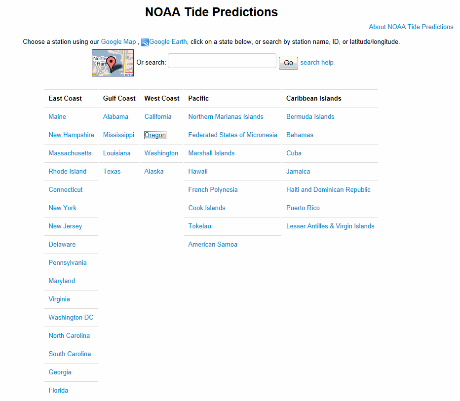
Stations are organized into the states or regions in which the station is located. Within each state, the stations are listed in geographical order, following the contours of the coastline, allowing stations physically near each other to be listed together. In areas where the states are separated by a river, stations on both sides of the river are provided in a single listing, progressing up the river from the coast. For example: the Potomac River separates Maryland and Virginia - all stations along the river will be listed under “Washington DC”. Clicking on the station name in the listings will access the tide predictions for the station.
Types of stations:
Tide predictions are provided for two “classifications” of stations - Harmonic and Subordinate.
Harmonic stations are stations with tidal harmonic constants and tidal datums. Tide predictions for harmonic stations are generated directly from the harmonic constants. Harmonic stations have the greatest capabilities within the NOAA Tide Predictions service for providing predictions with different data intervals and relative to different tidal datums. These capabilities are controlled within the interface.
Subordinate stations are historic stations which do not have tidal harmonic constants available. Tide predictions for subordinate stations are generated by first generating high/low tide predictions for a designated harmonic station, called the “reference station”; then time and height adjustments are applied to correct the high/low predictions to the tidal conditions at the subordinate station. Subordinate stations only allow for the generation of high/low tide predictions, and heights will be relative to Mean Lower Low Water (MLLW), the standard chart datum for the U.S. coastline.
The NOAA Tide Predictions interface:
Once a station is selected, the system provides the tide predictions for the current day and the following day.
Below the initial station predictions graphic is a user interface which allows you to control the predictions to be generated by the system.
- "Begin Date" – sets the starting day/month/year
- "Time Range" – sets the length of predictions, "Daily" (2-day predictions), "Weekly", or Monthly"
- “Time Zone” – sets the time zone that times are referenced to
- "LST/LDT" (Local Time with adjustment to Daylight Saving Time as appropriate)
- “LST” (Local Standard Time, no adjustment for Daylight Saving)
- “GMT” (Greenwich Mean Time)
- "Units" – sets the units of tide heights (Feet or Meters)
- Click the "Submit" button to generate updated predictions based on your updated settings.
Initial Station Screen: Daily Predictions

Advanced Options and Capabilities:
There are additional capabilities available under the "Show Advanced Options" link. Selecting this will open an interface box with additional options, allowing you to further "customize" the predictions generated.
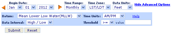
- Datum: Predictions can be generated relative to standard tidal or geodetic reference datum. (Harmonic Stations only)
- Data Interval: Predictions can be generated on several different time intervals (Harmonic Stations only)
- Time Units: Display AM/PM Time or 24-Hour Time
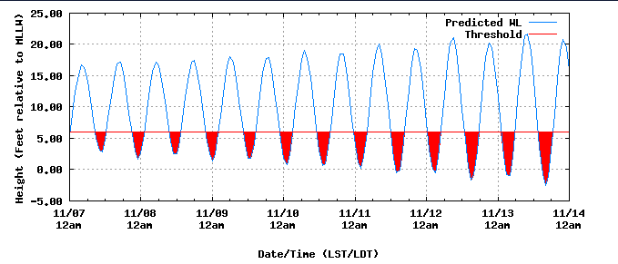
- Threshold: Highlights tides above or below a threshold height
- Note that Subordinate stations have limited "Advance Options" available.
- Remember to click the "Submit" button to generate updated predictions based any changes made to the advanced options or other settings.
Sample Threshold Graph: Weekly
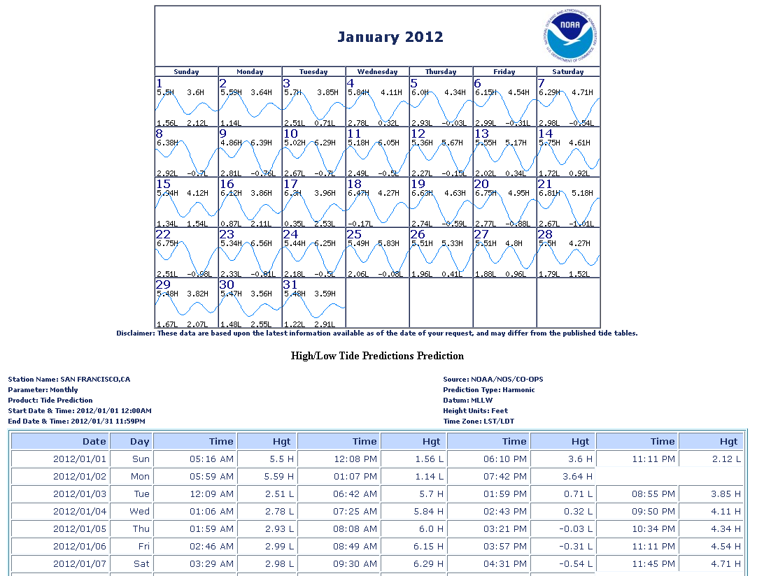
Annual Tide Predictions:
There are three buttons in the upper right hand corner, with the label "Published Tide Tables Formats". These buttons will allow you to generate high/low tide predictions for the calendar year and options selected set in the interface. The three buttons provide the annual tide predictions in the three available formats: PDF (3 months per page), TXT and XML.
Printable Displays and Download Formats:
- In the upper right side, there is a button for "Printer Friendly"; this link will generate a printable page of the predictions graphic and table.
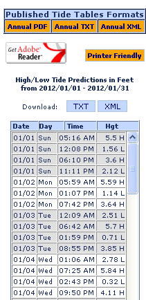
- On the right side, above the table of predictions, there are buttons to download the predictions displayed in the table as TXT or XML files.
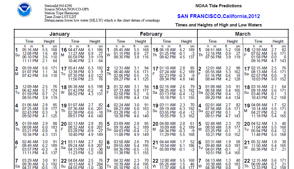
Sample Printer Friendly: Monthly
Sample Annual Predictions PDF
Updates to NOAA Tide Predictions
There are regular updates applied to the NOAA Tide Predictions. These updates are applied every quarter; during the first two weeks of January, April, July and October. The quarterly updates may include:
- The addition of new stations
- Upgrading a station from subordinate to harmonic
- Changes to the adjustment values and reference station for subordinate stations.
- The removal of superseded stations. These stations may have been replaced by a nearby station which provides more recent (more accurate) data upon which the predictions are based. Some stations may be removed because the available historic data does not allow for accurate predictions.
The number of stations updated and type of updates applied each quarter will vary depending on data collected and analysis completed during the quarter.
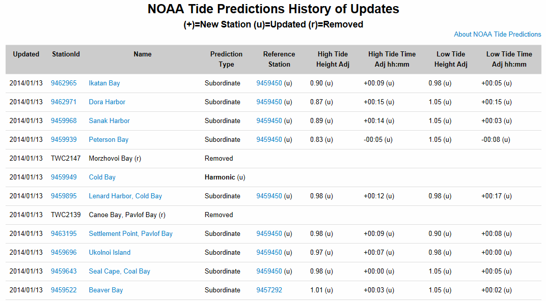
The History of Updates provides a listing of the stations updated each quarter, most recent updates appearing at the top. Each station updated will be listed along with information on the update applied.
History of Updates